The official site of the Tourist Board Split-Dalmatia County
17km
Trail info
LocationStari Grad
Length17 km
Duration
DifficultyMedium
Elevation264 m
Asphalt: 3.00 km
Macadam: 14.00 km
Bottom elevation1 m
Top elevation264 m
Start pointStari Grad
End pointStari Grad

FOLLOWING CHANGE THROUGH THE CENTURIES

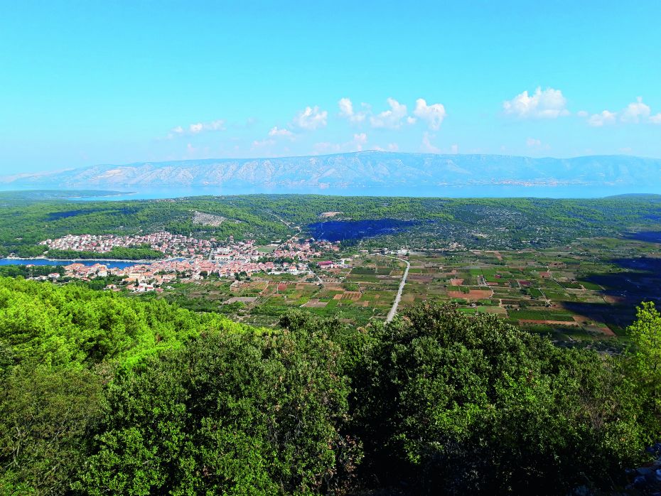
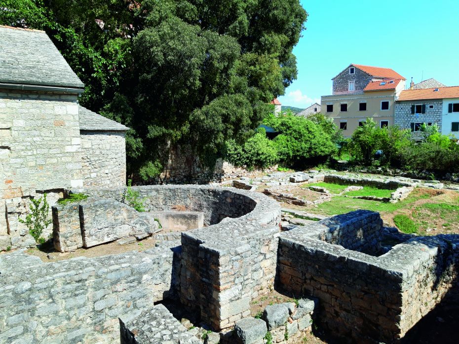
Under the patronage of Dionysius, the Elder of Syracuse, the Greeks from the island of Paros in the Aegean Sea founded the polis of Pharos in a deeply indented cove in the north-western part of the island of Hvar in 385-384 BC. Twenty-four centuries later, this settlement is called Stari Grad and is one of the two oldest towns in Croatia. The fertile Stari Grad Plain in its immediate vicinity still preserves the important heritage of the town’s founders. 
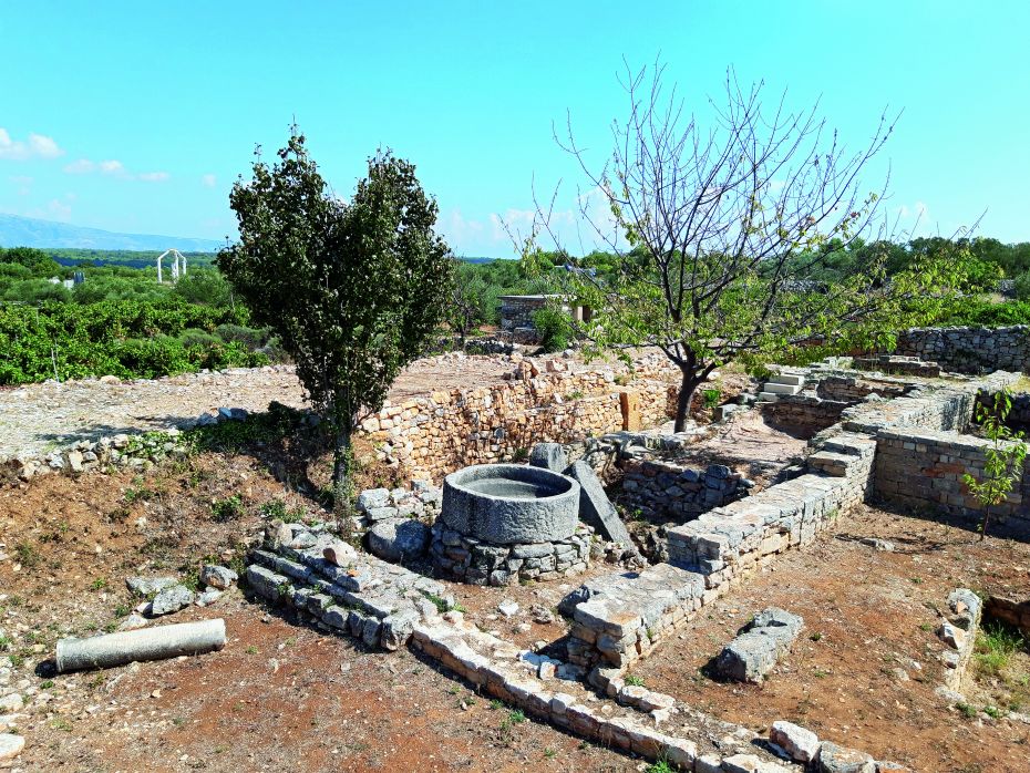
The Pharos hora is the best-preserved example of ancient Greek parcellation in the entire Mediterranean. Walking along the straight lines that divide the land, as it was laid out by Ionic Greeks 2,400 years ago in Stari Grad Plain, is like travelling back in time. This route reveals valuable heritage that was preserved throughout the centuries and which recalls the ancient Illyrians and Hellenic civilisations. Stari Grad Plain and the Stari Grad historic town centre were inscribed on the UNESCO World Heritage List in 2008.

  • Start 43º 11’ 2.818” N / 16º 35’ 56.368” E
    The Riva in Stari Grad; head eastwards onto Put Bana Josipa Jelačića
  • 0.53 km continue straight on towards Stari Grad Plain
  • 0.83 km Gospojica Chapel
  • 1.55 km turn right
  • 2.10 km bunja dry stone structure
  • 2.51 km remains of a Roman estate at Kupinovik
  • 2.63 km Žorkov (Ostojića) watermill
  • 2.68 km turn right onto the asphalt, and then immediately go onto a gravel path uphill towards the west (2.76 km)
  • 2.93 km continue straight on
  • 3.07 km continue straight on
  • 3.20 km arrival at an asphalt road; after 50 m westwards, turn immediately left onto a gravel path
  • 3.52 km continue straight on, and after 50 m go onto the trail
  • 4.13 km Likorova Kuća (Doctor’s House) at Budinjac Hill; after the house, take a sharp right
  • 4.56 km Purkin Kuk Hill (prehistoric (ritual) tumulus; Greek fortress); return the same way to Likorova Kuća
  • 4.99 km turn right downhill
  • 5.08 km turn right downhill
  • 5.32 km Church of St. Mary; turn left onto the gravel path and after 30 m take the asphalt road in Dol
  • 5.49 km turn right
  • 5.63 km turn left next to the Parish Church of St. Michael the Archangel
  • 5.74 km turn right
  • 5.80 km Church of St. Anne; turn right onto the road and after 30 m again turn right onto the trail
  • 5.92 km turn right
  • 6.00 km turn left onto the main trail
  • 6.24 km leave the road to the right, and go downhill; after
  • 30 m, cross the road and go onto an old path (6.40 km)
  • 6.73 km arrival at an asphalt road to the right; after 50 m, turn immediately left and go onto a path
  • 7.33 km cross the road and go onto a gravel path in Stari Grad Plain
  • 8.49 km turn left onto the main trail through Stari Grad Plain
  • 9.50 km bunja dry stone structure
  • 10.94 km return to the starting point

Google Street View

digital nomads