Along the Fortification line
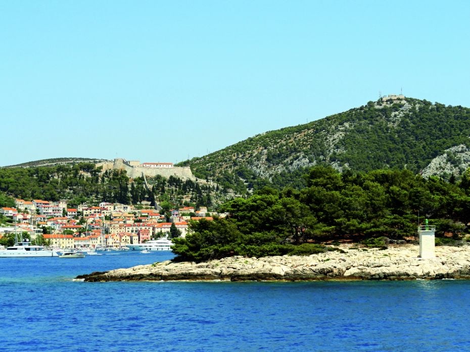
Surrounded by a system of fortifications and a natural barrier (the small islands that protect the approach to the town harbour), Hvar throughout its history played a vital role as a well-defended maritime stronghold along the eastern Adriatic coast.
LOCATION
Hvar
LENGTH
9.58 km
DURATION
03h 30min
DIFFICULTY
Hard
View more
This importance is also reflected in the town’s natural resources, especially the large fertile fields in the east and its natural water sources.
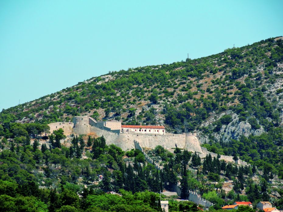
For centuries, the basis of the defensive line of the town of Hvar and its harbour was the Fortica fortress (also known as the Španjola or Spanish Fort) and the city walls. The Fortica was erected above the northern part of the town on the site of a former Illyrian fort and a Late Antiquity fortification complex. The construction of the fortress began around 1282 and ended in approximately 1551. Despite later extensions and repairs, the present appearance of the Fortica mostly dates back to the 16th century. During French rule in Dalmatia (1806-1813), the town of Hvar was additionally fortified. A remarkable building from this period is the Napoljun (Napoleon) fortification, which was erected in 1811 on the hill of Sveti Nikola (on the site of the medieval Church of St. Nicholas) to the north-east of Hvar.
 TRIAL INFO
Start your
adventure
TRAIL LINKS
DOWNLOADS
LOCATION
Hvar
DURATION
03h 30min
LENGTH
9.58 km
DIFFICULTY
Hard
ELEVATION
227 m
TYPE
Asphalt: 4.48 km
Macadam: 5.10 km
BOTTOM ELEVATION
1m
TOP ELEVATION
227m
START POINT
Hvar
END POINT
Hvar